Grid reference ST5710
near to Ryme Intrinseca, Dorset, England
Coverage
We have
17 images
in grid square ST5710
Contribute
Explore gridsquare ST5710
Surrounding area
Maps
 Map © Crown Copyright")
TIP: Click the map for more Large scale mapping
Tip: Click the map to open the coverage map
Sample images
Breakdown list
A sample of 12 photos from 17
for ST5710
- View this square in the Browser >>>

|
Bend on road approaching Ryme Intrinsica |

|
Maize field near Frankham Farm
by Nigel Mykura
Looking south just west of Ryme Intrinseca
|

|
A37 northbound, County Boundary |

|
Field boundary near Ryme Intrinseca
A wide headland has been left between the newly planted crop and the hedge.
|

|
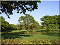
Ryme Intrinseca, Dorset |

|
A37 northbound |
|
Farmland, Lakegate Lane, Ryme Intrinseca
by William
View from bank alongside road across fields of Caswell Farm
|

|
Entrance to the village of Ryme Intrinseca
by Mike Smith
This is the village name sign and other signs you will see when entering the village from the west.
|

|
Barn near Ryme Intrinseca
by Nigel Mykura
This barn is just off Lakegate Lane close to where it joins the A37 Yeovil to Dorchester road
|

|
Cottage at Ryme Intrinseca
by Mike Searle
|

|
Benchmark, Glyde's Cottage, Ryme Intrinseca
Ordnance Survey benchmark, described on database at Link
|

|
Houses at the edge of Ryme Intrinseca |
Explore more images in this square: | View Filtering options | View all 17 images page by page >>> |
|