Grid reference SS8387
3 km from Llangynwyd, Bridgend/Pen-y-Bont ar Ogwr, Wales
Coverage
We have
12 images
in grid square SS8387
Contribute
Explore gridsquare SS8387
Surrounding area
Maps
 Map © Crown Copyright")
TIP: Click the map for more Large scale mapping
Tip: Click the map to open the coverage map
We have
12 images
for SS8387

|
Cwm Cynffig
by eswales
Towards the northern end of this mostly-forested valley, at a point where one of its slopes consists of open land.
|

|
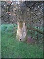
Broken earthwork in Cwm Kenfig
by Nigel Davies
This looks like quite a significant earthwork. There is no indication that it has held back any water for a long time.
The wall is much deeper on the downstream side than on the upstream side pictured. The infant river Kenfig is just a... (more)
|

|
Ogwr Ridgeway Walk
by Alan Hughes
The path of the Ogwr Ridgeway Walk runs alongside the Cwm Cynffig valley.
|

|
Mynydd Margam
Cerddwyr yn dilyn Ffordd Sant Illtyd ar Fynydd Margam.
Walkers following the St Illtyd's Walk on Mynydd Margam (trans. ?Morgan's Mountain).
|

|
View down Cwm Cynffig
by eswales
Photograph taken from a similar spot to SS8387 : Cwm Cynffig but looking in a different direction, roughly eastwards down the valley.
|

|
Track in the north of Coed Cwm Kenfig
by eswales
In the distance can be seen some the northernmost part of the forest, lying in the upper quarter of the grid square.
|

|
Track junction in the north of Coed Cwm Kenfig
by eswales
Although the track to the left (which continues behind the photographer's position) is marked as tracks conventionally are on Ordnance Survey's 1:50,000 map of the area, the one striking off to the right is represented only as a footpath.
|

|
Cwm Cynffig at forest's end
by eswales
View across Cwm Cynffig showing the boundary at the northern end of the forestry on the slope to the east of the Afon Cynffig. Forestry continues northwards of this point for some distance on the near slope of the valley, to the river's west.
|
|
Trig pillar on Moel Ton-mawr
by Nigel Davies
Not the easiest to find. This section of the forest has no paths and is frequently blocked by rotten, fallen trees. Even the clearing that surrounds the trig point is not immune.
|

|
Cerddwyr wrth groesffordd o draciau / Walkers at a crossroads of tracks
Cerddwyr wrth groesffordd o draciau ar Fynydd Margam wrth ddilyn Ffordd Sant Illtyd.
Walkers at a crossroads of tracks on Mynydd Margam (trans. ?Morgan's Mountain) while following the St Illtyd's Way.
|

|
Cwar Moel Tonmawr / Moel Tonmawr Quarry
Mae llwybr troed yn agosau at hen Gwar Moel Tonmawr.
A public footpath approaches the site of the disused Moel Tonmawr Quarry (trans. bare hilltop of the large lea-land).
|

|
Cyffordd o draciau / A junction of tracks
Cyffordd o draciau o fewn planhigfa gonifferraidd.
A junction of tracks within a conifer plantation.
|
|