Grid reference SE3382
near to Sinderby, North Yorkshire, England
Coverage
We have
8 images
in grid square SE3382
Contribute
Explore gridsquare SE3382
Surrounding area
Maps
 Map © Crown Copyright")
TIP: Click the map for more Large scale mapping
Tip: Click the map to open the coverage map
We have
8 images
for SE3382
|
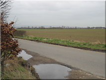
Road and field
by TIM CHAPMAN
|

|
Farmland near Pickhill
Arable field near Pickhill with stacked straw bales.
|

|
Street Lane, Pickhill
by Chris Heaton
This road run west from Pickhill, to cross the newly opened A1(M) to reach the A6055, which runs parallel alongside the motorway.
The A6055 used to be the northbound carriageway of the A1, but has now been downgraded to feed minor roads... (more)
|

|
Frozen field entrance off Street Lane
by JThomas
|

|
Street Lane, Pickhill
The view westwards along Street Lane is changing due to the construction of the A1 Motorway, the six lanes of which are sited a little further east than the old A1. A new bridge can be seen to the left, and this will take local traffic over... (more)
|

|
Street Lane
by JThomas
Looking south west.
|

|
Northbound A1(M) near to Sinderby
by David Dixon
|

|
Street Lane near Pickhill
by Steven Brown
|
|