Grid reference SU5029
near to Chilcomb, Hampshire, England
Coverage
We have
29 images
in grid square SU5029
Contribute
Explore gridsquare SU5029
Surrounding area
Maps
 Map © Crown Copyright")
TIP: Click the map for more Large scale mapping
Tip: Click the map to open the coverage map
Sample images
Breakdown list
images taken from SU5029 [2]
A sample of 12 photos from 29
for SU5029
- View this square in the Browser >>>

|
Kings Lane
The way to Chilcomb.
|

|
Fields south of Alresford Road
by Peter Jordan
Looking north in a shower across fields to Alresfords Road which runs along the line of trees.
|

|
A31, eastbound
by N Chadwick
|

|
Fair Lane approaching Winnall Down
by Mr Ignavy
|

|
The entrance to Leigh House hospital, Alresford Road
by David Howard
|

|
Magdalen Hill Down
by Peter Facey
|

|
A31 junction with Kings Lane
by Stuart Logan
|

|
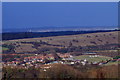
View from Fair Lane towards Winnall Down Farm
On a misty morning.
|

|
Field near Magdalen Hill Farm
by David Martin
|

|
City of Winchester : Petersfield Road A31
by Lewis Clarke
The A31 heading through the City of Winchester District.
|
|
Morn Hill
by Pierre Terre
|

|
Old Boundary Marker by the B3404, Alresford Road, Winchester parish
by M Faherty
Municipal Boundary Marker by the B3404, in parish of Winchester (Winchester District), Alresford Road, at entrance to Winnall Down Farm on grass. In 1932 Chilcomb Without parish was split between Winchester parish and the remainder retitled... (more)
|
Explore more images in this square: | View Filtering options | View all 29 images page by page >>> |
|