Grid reference SO8451
near to Powick, Worcestershire, England
Coverage
We have
101 images
in grid square SO8451
Contribute
Explore gridsquare SO8451
Surrounding area
Maps
 Map © Crown Copyright")
TIP: Click the map for more Large scale mapping
Tip: Click the map to open the coverage map
A sample of 12 photos from 101
for SO8451
- View this square in the Browser >>>

|
Parapet of A4440 bridge over bridleway and farm track
by David Smith
A short way beyond the end of the bridge, there is a slip road for farm vehicles from the track below (beside the grey car)
|

|
Oak tree beside the southern relief road
This oak tree despite being close to the roadworks widening Worcester's southern relief road.
|

|
Severn/Teme Flood Plain Under Water
by Bob Embleton
Taken from almost the same point as my November 2005 photo SO8451 : Flood Plain of the rivers Severn and Teme. The prediction was that the Severn would peak today. It has taken three to five days to peak from the heaviest rain in the North Wales catchment area. Flood barriers are... (more)
|

|
Snow covered Malverns beyond Power park
by Andrew Darge
Well trodden snow on this 'dog walking' space beneath the powerlines south of Worcester . The A4440 southern link road is in the middle ground heading for the Severn crossing at Carrington bridge.
|

|
Severn floods
Winter flooding viewed from the embankment of the Worcester southern by-pass. Looking north to the sunlit Worcester city centre. The fence below indicates that the water is perhaps four feet deep here. The caravan site on the right is on a... (more)
|

|
View of the flood plain from the A4440 south of Worcester
by Jeff Gogarty
The trees mark the path of the River Teme.
|

|
Preparing to dual Worcester's southern bypass
Trees have been cut down in preparation for the dualling of Worcester's southern bypass.
|

|
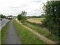
Temeside Way |
|
Bypass blues
The Worcester bypass's busiest section across the Teme and Severn flood plain. Under-engineered for width, with numerous inadequate junctions: predictable congestion throughout the day.
|

|
Line of pylons towards Great Malvern
by Bill Boaden
The pylons are crossing flooding from the River Severn. In the foreground is intended improvement of the A4440.
|

|
View of the Malverns
by Andrew Darge
The Malverns seen across the flood plain of the Severn from the viewpoint at Carrington bridge.
|

|
Landmarks south of Worcester
by Andrew Darge
Now that the southern ring road past Worcester is generally perpetually slow moving one has plenty of time to pick out the chimney of the old Powick power station originally powered by the Teme and the splendid, much photographed, oak that... (more)
|
Explore more images in this square: | View Filtering options | View all 101 images page by page >>> |
|