Grid reference SE3208
near to Gawber, Barnsley, England
Coverage
We have
27 images
in grid square SE3208
Contribute
Explore gridsquare SE3208
Surrounding area
Maps
 Map © Crown Copyright")
TIP: Click the map for more Large scale mapping
Tip: Click the map to open the coverage map
Sample images
Breakdown list
A sample of 12 photos from 27
for SE3208
- View this square in the Browser >>>

|
Industrial Unit, Zenith Park
by JThomas
|

|
Forlorn horse in The Dearne Valley
by Neil Theasby
South of Mapplewell and the river
|

|
Fields and Woodland viewed from the Dearne Way
Looking in the direction of Swallow Hill.
|

|
The Barnsley Canal
by Graham Hogg
This section of the canal ran from Barnsley to Barnby Basin; it was constructed in early 1802 and closed in 1953. Only short stretches now remain in water.
|

|
Bath night!
Old baths used as drinking troughs for horses.
|

|
End of the Barnsley Canal
by Martin Speck
This is the end of the Barnsley Canal. The map shows it as being full of water but today it is completely dry at this point.
|

|
Pylons near Redbrook, Barnsley
by Ian S
|

|
Footbridge over the River Dearne
by John Slater
|
|
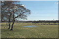
Pasture land north of Gawber
by Chris Yeates
Even on the 1940s OS map the canal that once crossed this area is described as 'disused'. What remains now is an extensive area of grassland and sheep-grazed rush-pasture, with areas of open water - a haven for birds, mammals and... (more)
|

|
Distant Mapplewell
by Chris Morgan
Beyond the power lines and cows gathering in the evening sunshine
|

|
The River Dearne below Barugh Bridge
After prolonged rain fall.
|

|
Close up of calcified pipe with water emerging from disused coal mine |
Explore more images in this square: | View Filtering options | View all 27 images page by page >>> |
|