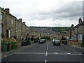
Grid reference SE1315
near to Huddersfield, Kirklees, England
Coverage
We have
417 images
in grid square SE1315
Contribute
Explore gridsquare SE1315
Surrounding area
Maps
 Map © Crown Copyright")
TIP: Click the map for more Large scale mapping
Tip: Click the map to open the coverage map
A sample of 12 photos from 417
for SE1315
- View this square in the Browser >>>

|
Lockwood Baptist Church, Lockwood Road |

|
Pear Tree Mews, Huddersfield
by habiloid
A close-up of the post box can be seen in SE1315 : Post box, Blackmoorfoot Road, Huddersfield.
|

|
Dereliction, Back Moor End Road, Lockwood
The 1:1250 map of the early 1970s suggests that some of the rear ground floor of the terrace were under-dwellings, whilst some were basements of the house above. It looks as if the derelict land belongs mainly to the under-dwellings that... (more)
|

|
Roofscape
Industrial development in Lockwood
|

|
Birkhouse Bridge, Huddersfield Narrow Canal
Looking west. This bridge carries a minor lane.
|

|
View to Spa Baths
This is the view from the Bath Hotel to the Baths themselves if you can imagine the space between was laid out as a Ornamental Garden planted with flowers,
shrubs and small trees with narrow paths meandering in between and the other side... (more)
|

|
Lockwood Bar
A busy crossroads where the main road south from Huddersfield diverges into routes to Milnsbridge, Meltham and Holmfirth.
According to another contributor the building on the corner shown here dates from 1802 and was the toll house... (more)
|

|
Houses at the foot of Lockwood Scar, Salford, Almondbury
The pair of three-storey houses are Grade 2 listed, and are of the early or mid 19C, built of hammer-dressed stone with ashlar dressings and a stone-slate roof. The far side has loading doors on the first and second floors; the first-floor... (more)
|

|
The Lockwood public house, Huddersfield
by JThomas
On Woodhead Road.
|

|
Islamic Library on St Stephen's Road, Huddersfield
by Ian S
|
|
Moorbottom Road - viewed from Thorne Road (set of 2 images) |

|
River Holme in Lockwood Huddersfield |
Explore more images in this square: | View Filtering options | View all 417 images page by page >>> |
|